

Preview
Document Type
StillImage
Contributing Institution
Maine State Archives
Identifier
209522
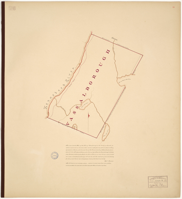
Description
Plan of Vassalboro on a scale of 200 rods to an inch. Copied from Massachusetts Archives Maps and Plans #1385.
Exact Creation Date
1-1795
Language
English
Location
Kennebec County; Vassalboro
Other Location
Three Mile Pond; Seven Mile Pond; Seven Mile Brook; Kennebec River; Specticle Pond
Keywords
Cartography; Maps; Maine Land Office; Planbooks; Surveys
Image Location
Rights Statement
No Copyright - United States. URI: http://rightsstatements.org/vocab/NoC-US/1.0/
The organization that has made the Item available believes that the Item is in the Public Domain under the laws of the United States, but a determination was not made as to its copyright status under the copyright laws of other countries. The Item may not be in the Public Domain under the laws of other countries. Please refer to the organization that has made the Item available for more information.