

Preview
Contributing Institution
Maine State Archives
Document Type
StillImage
Identifier
302963
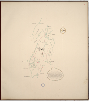
Description
Page 1 of the Sagadahoc County planbook. Survey of the town of Bath copied from the Massachusetts Archives Maps and Plans #1345.
Exact Creation Date
3-7-1795
Language
English
Location
Sagadahoc County; Bath
Other Location
Georgetown; Winnegance Creek; Harpswell; Birch Point; Mill Creek; Stephens River; Kennebeck River; Kennebec; Merremeeting Bay; Merrymeeting Bay; Brunswick; Whesgig Bridge; Lines Island; Woolwich
Keywords
Cartography; Maps; Maine Land Office; Planbooks; Surveys
Image Location
Rights Statement
No Copyright - United States. URI: http://rightsstatements.org/vocab/NoC-US/1.0/
The organization that has made the Item available believes that the Item is in the Public Domain under the laws of the United States, but a determination was not made as to its copyright status under the copyright laws of other countries. The Item may not be in the Public Domain under the laws of other countries. Please refer to the organization that has made the Item available for more information.