

Preview
Document Type
StillImage
Contributing Institution
Maine State Archives
Identifier
299004
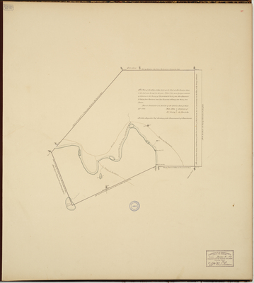
Description
Survey of two townships of Freeman and New Portland in Lincoln County (now Somerset and Franklin counties) granted to the "sufferers of Portland." These plots of land of six miles square were granted to residents of Falmouth who had lost their homes and land when British forces burned the town in 1775.
Copied from Massachusetts Archives Maps and Plans #1382.
Exact Creation Date
1791
Language
English
Location
Somerset County; New Portland; Franklin County; Freeman Twp
Other Location
Kennebec River; Seven Mile River
Keywords
Cartography; Maps; Maine Land Office; Planbooks; Surveys
Image Location
Rights Statement
No Copyright - United States. URI: http://rightsstatements.org/vocab/NoC-US/1.0/
The organization that has made the Item available believes that the Item is in the Public Domain under the laws of the United States, but a determination was not made as to its copyright status under the copyright laws of other countries. The Item may not be in the Public Domain under the laws of other countries. Please refer to the organization that has made the Item available for more information.