

Preview
Document Type
StillImage
Contributing Institution
Maine State Archives
Identifier
210848
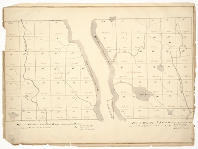
Description
Survey of T4 R12 and T4 R13 on a scale of 40 chains to an inch.
Exact Creation Date
1835
Language
English
Location
Piscataquis County; T4 R12 WELS; T4 R13 WELS
Other Location
Mud Pond; Ripogenus Strea; Chesuncook Lake; Pine Stream
Keywords
Cartography; Maps; Maine Land Office; Planbooks; Surveys
Image Location
Rights Statement
No Copyright - United States. URI: http://rightsstatements.org/vocab/NoC-US/1.0/
The organization that has made the Item available believes that the Item is in the Public Domain under the laws of the United States, but a determination was not made as to its copyright status under the copyright laws of other countries. The Item may not be in the Public Domain under the laws of other countries. Please refer to the organization that has made the Item available for more information.