


Preview
Contributing Institution
Maine Geological Survey
Document Type
Image
Identifier
67167
Description
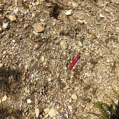
In addition to the Kanokolus Esker, several smaller esker segments can be found in the eastern part of the quadrangle. This photo shows a sand and gravel exposure from an esker ridge in the Bog Brook Valley.
Project Name: STATEMAP Unity Pond Surficial
Location
Troy
Supplemental Rights
Credit must be given to the photographer and the Maine Geological Survey when this photo is displayed, reproduced, distributed and/or used in derivative works.
Keywords
STATEMAP; surficial geology; Unity Pond quadrangle; esker; gravel