


Preview
Contributing Institution
Maine Geological Survey
Document Type
Image
Identifier
58144
Description
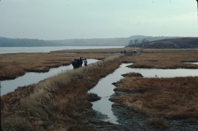
3-B-20. Colonial salt marsh dike (partly inundated by rising sea level), Crocker Point, Machiasport.
Project Name: Thompson NGGDPP Grant 2020
Exact Creation Date
10-1-1980
Location
Machiasport
Supplemental Rights
Credit must be given to the photographer and the Maine Geological Survey when this photo is displayed, reproduced, distributed and/or used in derivative works.
Keywords
Salt marsh dike; sea level change; Machiasport; Washington County