

Preview
Document Type
StillImage
Contributing Institution
Maine State Archives
Identifier
BMC-19 p.48; 206791
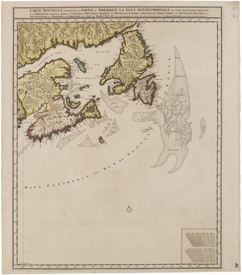
Description
Map of southeastern Canada and Newfoundland. Includes Nova Scotia and Acadia, Gulf of St. Lawrence, Cape Breton, and the Grand Banks fishing grounds.
Broad Creation Date
ca. 1718
Dimensions
24.25" x 21.25"
Language
French
Keywords
Cartography; Maps; Canada; Grand Banks