

Preview
Contributing Institution
Maine State Archives
Document Type
StillImage
Identifier
29453
Description
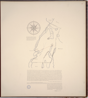
Page 21 of the Lincoln County planbook. Survey of the town of Nobleboro on a scale of 200 poles to an inch. Copied from Massachusetts Archives Maps and Plans #1371.
Exact Creation Date
1794
Language
English
Location
Lincoln County; Nobleboro
Other Location
Browns Cove; Bristol; Salt Bay; Austen Crick Bridge; Mescovus Bay; Ballstown; Great Bay; Cooks Pond; Damascotty River; Damariscotta River; Duck Puddle Pond; Pemequed Pond;
Keywords
Cartography; Maps; Maine Land Office; Planbooks; Surveys
Image Location
Rights Statement
No Copyright - United States. URI: http://rightsstatements.org/vocab/NoC-US/1.0/
The organization that has made the Item available believes that the Item is in the Public Domain under the laws of the United States, but a determination was not made as to its copyright status under the copyright laws of other countries. The Item may not be in the Public Domain under the laws of other countries. Please refer to the organization that has made the Item available for more information.