

Preview
Document Type
StillImage
Contributing Institution
Maine State Archives
Identifier
209714
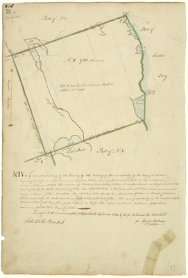
Description
Survey of Township 4 (Robbinston area), on a scale of 200 rods to an inch.
Exact Creation Date
9-1784
Language
English
Location
Washington County
Other Location
East Pond; Schoodic Bay; Liberty Point; Moose Horn River; Lowes Cove; St. Andrew's Bay
Keywords
Cartography; Maps; Maine Land Office; Planbooks; Surveys