

Preview
Document Type
StillImage
Contributing Institution
Maine State Archives
Identifier
208461
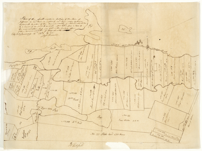
Description
Plan of southwestern area of Jefferson on a scale of 80 rods to an inch.
Broad Creation Date
1814-1836
Language
English
Location
Lincoln County; Jefferson
Other Location
Dyer Pond; Whitefield
Keywords
Cartography; Maps; Maine Land Office; Planbooks; Surveys
Image Location
Rights Statement
No Copyright - United States. URI: http://rightsstatements.org/vocab/NoC-US/1.0/
The organization that has made the Item available believes that the Item is in the Public Domain under the laws of the United States, but a determination was not made as to its copyright status under the copyright laws of other countries. The Item may not be in the Public Domain under the laws of other countries. Please refer to the organization that has made the Item available for more information.