

Preview
Document Type
StillImage
Contributing Institution
Maine State Archives
Identifier
209948
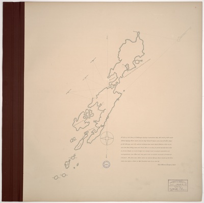
Description
Page 9. Survey of Islesboro. Scale of 200 rods to 1 inch. Copied from #1331 Maps and Plans, MA Archives.
Language
English
Location
Waldo County; Islesboro
Other Location
Islesborough; Mark Island; Saddle Island; Laydels Island; Lasalle Island; Lime Island; Jobs Island; Ensign Island; Spruce Island; Dark Harbor; Seven Hundred Acre Island; Nals Island; Narrow Harbor; Geile Harbour; Gilkey's Harbor; Sabbath Day Harbor; Penobscot Bay; Turtle Head; Bagwaduce Fort; Bagaduce Fort; Castine
Keywords
Maine Land Office; Maps; Planbook; Survey
Rights Statement
No Copyright - United States. URI: http://rightsstatements.org/vocab/NoC-US/1.0/
The organization that has made the Item available believes that the Item is in the Public Domain under the laws of the United States, but a determination was not made as to its copyright status under the copyright laws of other countries. The Item may not be in the Public Domain under the laws of other countries. Please refer to the organization that has made the Item available for more information.