

Preview
Contributing Institution
Maine State Archives
Document Type
StillImage
Identifier
208424
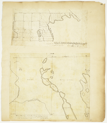
Description
Plan of the south half of T1 R2 NBPP Titcomb's Survey (now Lambert Lake Plantation), 1832
Plan of T4 R1 NBPP (Lakeville Plantation), 1832
Exact Creation Date
1832
Language
English
Location
Penobscot County; Lakeville; Washington County; Lambert Lake Twp
Other Location
Passadumkeag River; St. Croix River; Tomah Stream; Simsquish Lake
Keywords
Cartography; Maps; Maine Land Office; Planbooks; Surveys
Rights Statement
No Copyright - United States. URI: http://rightsstatements.org/vocab/NoC-US/1.0/
The organization that has made the Item available believes that the Item is in the Public Domain under the laws of the United States, but a determination was not made as to its copyright status under the copyright laws of other countries. The Item may not be in the Public Domain under the laws of other countries. Please refer to the organization that has made the Item available for more information.