


The Maine Geological Survey provides the people and businesses of Maine with essential geologic information about the land where we live and work.
Note: Many state documents are offered in PDF format. To view PDF documents, you will need the free Adobe Reader. If you need assistance, view our Maine government PDF Help page or contact the contributing Maine State agency via the link on the left sidebar under “Links”.
-

Beach Scraping at Popham Beach State Park
Stephen M. Dickson
Maine Geological Survey, Geologic Facts and Localities, Circular GFL-177
-

Sampling the Gulf of Maine Seabed from the Ocean Survey Vessel Bold
Stephen M. Dickson and Kara Jacobacci
Maine Geological Survey, Geologic Facts and Localities, Circular GFL-185
-

Geology of Sentinel Mountain, Baxter State Park
Robert A. Johnston
Maine Geological Survey, Geologic Facts and Localities, Circular GFL-183
-

Measurement of Stream Discharge Using Weirs and Flumes
Daniel B. Locke
Maine Geological Survey, Geologic Facts and Localities, Circular GFL-178
-

Some Geological Features at Whitecap Mountain, Rumford, Maine
Robert G. Marvinney
Maine Geological Survey, Geologic Facts and Localities, Circular GFL-176
-

Sugarloaf Mountain near Shin Pond, Maine - A Classic Geological Locality
Robert G. Marvinney
Maine Geological Survey, Geologic Facts and Localities, Circular GFL-182
-

Watching the Tides: The 100th Anniversary of the Portland Tidal Station
Peter A. Slovinsky
Maine Geological Survey, Geologic Facts and Localities, Circular GFL-180
-
 Geologic Features Under Different Lighting Conditions by Woodrow B. Thompson")
A Trick of the Light: Seeing (or Not Seeing) Geologic Features Under Different Lighting Conditions
Woodrow B. Thompson
Maine Geological Survey, Geologic Facts and Localities, Circular GFL-181
-

Big Rock - An Erratic in Waltham, Maine
Thomas K. Weddle
Maine Geological Survey, Geologic Facts and Localities, Circular GFL-186
-

Orris Falls Conservation Area and the Great Balancing Rock of Tatnic
Thomas K. Weddle
Maine Geological Survey, Geologic Facts and Localities, Circular GFL-179
-

La Verna Preserve, Bristol, Maine
Henry N. Berry IV
Maine Geological Survey, Geologic Facts and Localities, Circular GFL-172
-

Settlement Quarry, Stonington, Maine
Henry N. Berry IV
Maine Geological Survey, Geologic Facts and Localities, Circular GFL-169
-

Setting the Stage for a Course Change at Popham Beach
Stephen M. Dickson
Maine Geological Survey, Geologic Facts and Localities, Circular GFL-165
-

Geology of Horse Mountain, Baxter State Park
Robert A. Johnston
Maine Geological Survey, Geologic Facts and Localities, Circular GFL-173
-

North Ridge, Traveler Mountain, Baxter State Park
Robert A. Johnston
Maine Geological Survey, Geologic Facts and Localities, Circular GFL-170
-

Maine's Dug Wells
Daniel B. Locke
Maine Geological Survey, Geologic Facts and Localities, Circular GFL-166
-

A Geological Tour of Bartlett Narrows and Vicinity
Robert G. Marvinney
Maine Geological Survey, Geologic Facts and Localities, Circular GFL-164
-

Stratigraphy and structural geology of the Bangor and Veazie 7.5' quadrangles
Stephen G. Pollock
Maine Geological Survey, Open-File Report 11-147. Accompanies Open-File Maps 11-57 and 11-58
-

Shoreline Erosion at Western and Ferry Beaches, Scarborough, Maine
Peter A. Slovinsky
Maine Geological Survey, Geologic Facts and Localities, Circular GFL-171
-

Simulating Future Impacts of Sea Level Rise on Coastal Wetlands: An example from Scarborough, Maine
Peter A. Slovinsky
Maine Geological Survey, Geologic Facts and Localities, Circular GFL-168
-

State of Maine's Beaches in 2011
Peter A. Slovinsky and Stephen M. Dickson
Maine Geological Survey, Open-File Report 11-149 (online edition). Provides a description of the changes observed at Maine beaches that are monitored as part of the State of Maine Beach Profiling Project
-

Surficial geology of the Hampden 7.5' quadrangle, Hancock, Penobscot, and Waldo Counties, Maine
Kent M. Syverson and Jeffrey D. Olson
Maine Geological Survey, Open-File Report 11-7.
-

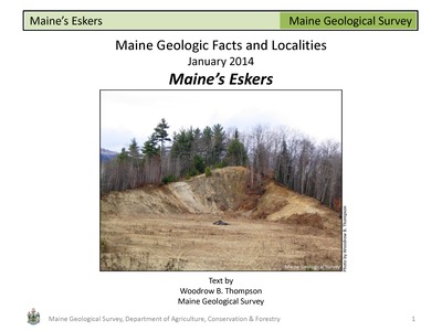
Lidar Imagery Reveals Maine's Land Surface in Unprecedented Detail
Woodrow B. Thompson
Maine Geological Survey, Geologic Facts and Localities, Circular GFL-175
-

Sea-Level Rise and the Damariscotta River Oyster Shell Middens
Thomas K. Weddle
Maine Geological Survey, Geologic Facts and Localities, Circular GFL-167
-

The Landscape of Mount Desert Island Past and Present
Thomas K. Weddle and Dave Manski
Maine Geological Survey, Geologic Facts and Localities, Circular GFL-174