

Preview
Document Type
StillImage
Contributing Institution
Maine State Archives
Identifier
206849
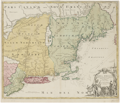
Description
Map of the northeastern colonies in North America. It is an amalgam of Dutch and English sources, and depicts such inaccuracies as the strait cutting across Cape Cod near Eastham, a larger Lake Champlain, and several mythical lakes in New York.
Broad Creation Date
ca. 1720
Dimensions
20" x 23"
Language
Latin
Other Location
New England
Keywords
Cartography; Maps